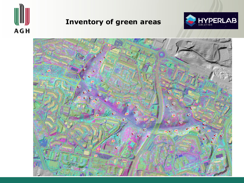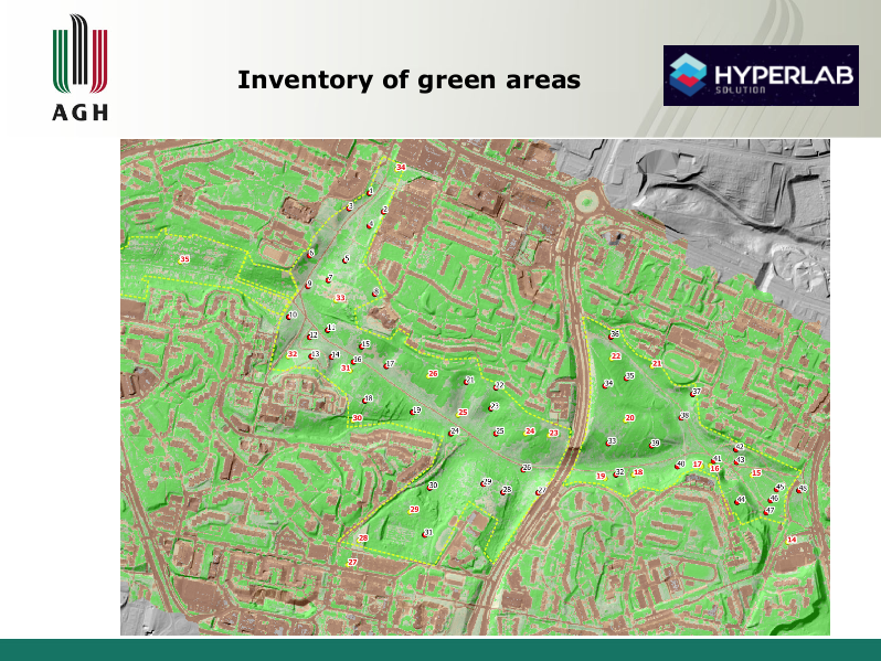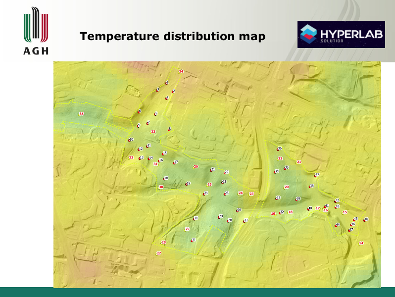
From the drone you will see more…
Inspections of agricultural areas carried out with the help of Unmanned Aerial Vehicles (UAVs) using various measurement sensors allow you to monitor areas counted in hundreds of hectares that cannot be covered with traditional methods. Depending on the number of channels, we divide them into multispectral (several channels), superspectral and hyperspectral (several dozen or more channels). The quality of the camera is determined not only by the number of channels, but also by the resolution and speed of operation. The use of various types of sensors and image registration not only in the range of visible light (as in a color photograph), but also microwaves, infrared and ultraviolet gives results that cannot be achieved by the human eye. Provided information on soil fertility, moisture status, identification of damage caused by pests and estimation of future crops visualized in the form of maps allows you to make effective decisions and respond to threats.Applied in agriculture, it allows effective management of irrigation, fertilization, soil and all crops, thanks to the reduction of spraying, fertilizer or water consumption, and contributes to an increase in yields.

Image Slider